So Vienna…
Vienna, was not my favorite city. We got lost, constantly!
So we got there at the Southern Station and then had to go to the Western Station where our hostel was. We got on the tram and there was no where to put luggage, thankfully this really nice older guy gave up his seat so that we could get our luggage out of the isle. He also told us how many stops we had to go. Really friendly guy.
Got to our hostel and they told us we’d have to wait 3 hours before our room was ready! This was at 15:00!! So we put our luggage in storage and explored the area around our hostel some, found a grocery store to buy food in. I was carrying around a bunch of things of yogurt. Well, I dropped one and right next to where someone else had JUST broken a whole bottle of wine. Well the lady who was cleaning up the wine started yelling at me in German and I didn’t understand! :'(
Anyways, the first full day there we headed over to the Hofburg Complex. We wondered around that for a while and then went and saw the royal Imperial Apartments and Silver Collection. Both were very cool. After that we wondered around some more and they were setting up for some crazy Luxury living event thing. After that we tried finding our next activity, but we got lost and ended up next to the Rathaus City hall building where they were having a Christmas Market. Which is honestly one of my FAVORITE things about traveling in Europe at this time of year. They are absolutely wonderful! We shopped around there for a little bit and got lunch there. From there we headed over to the Sigmund Freud Museum which was very cool to see where he actually worked and lived. I wished they had more of his original stuff there, but they did have the waiting room setup the way he had it. We ended the day going to a Imperial Crypt in a church which wasn’t exactly what I was expecting, but still kinda cool.
The second day we walked around a lot, saw the Stephansdom which was neat. Around the corner from it was a place called Haas & Haas, we went back a few days later for some AMAZING dessert and tea! , found a cool Memorial which was all in Russian, so Constantine could read it. lol. I can’t remeber the exact name of it though and I don’t have the book with me to look it up. I was honestly surprised it was still standing. After that we headed over to the Belvedere and saw all the art there which was nice. That evening we went out and found the State Opera house which was really pretty all lit up at night and we saw a concert at the smaller Music theater next door. There were three encores! It was really good and I’m glad we went to it. After that we headed over to the famous Sacher for a slice of Sachertorte. Amazing! 🙂
The third day we headed to the nation museums which were cool in the MuseumsQuartier. We saw Museum Moderner Kunst Stiftung Ludwig Wien and the Kunsthistorisches Museum. Both of them were really cool. It was also sunny that day so we took advantage of that and walked back over to the Stephansdom to take more pics of that. That night we headed out to Mango Bar which was lots of fun.
The last day in Vienna we went out to the Schloss Schonbrunn Palace. This place was amazing, and I highly suggest the longer tour as they save the best rooms for that tour! I was sad that it was so cloudy that day! That evening we headed back over to the Rathaus to take night time shots. Did some last minute shopping and then ate dinner at Cafe Resturant Landtmann which was just delicious! We then headed out to another gay bar called Heaven. The place was a dud. 🙁
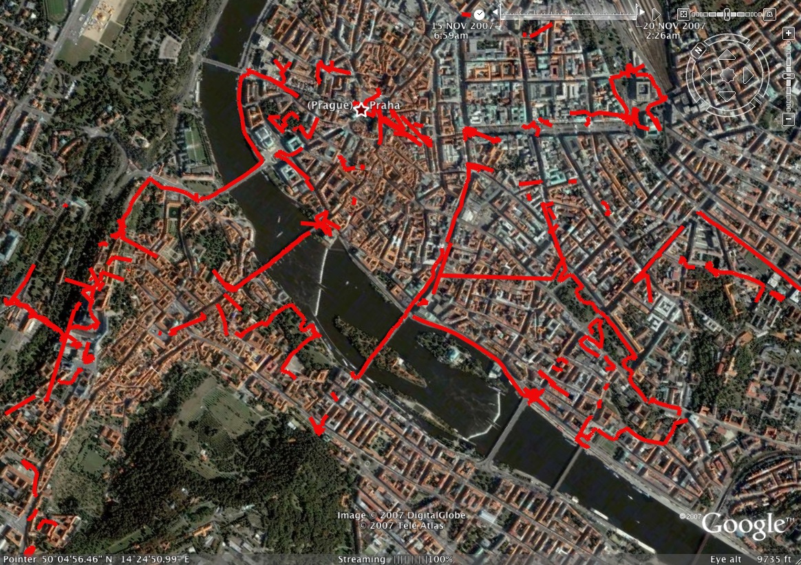
The next day we took the train back to Prague and spent the night at the hotel by the airport. We totally wanted to go try and find some hot Czech boy porn, but the only place that looked any good was closed that night! 🙁
The flights back to LA were hellish. I got yelled at by the Air France people because the place was “Ready to leave”. I got stopped TWICE at different security points. The second one was AT the door to get on the plane and the woman was a total bitch. Made me take EVERYTHING out of my backpack. My wallet set off the metal detector because I have an extra key in there, so she made me empty that entire thing. All while the Air France lady is yelling at ME to hurry up because the plane is ready to go. Then we get on the plane and there is no where for me to put my baggage in the overhead thing and they are yelling at me to take my seat. They run out of Chicken dinners by the time they get back to me and only have Salmon, and I don’t eat that shit. Just an absolute nightmare! UGH!
Thank god the rest of the trip was excellent.
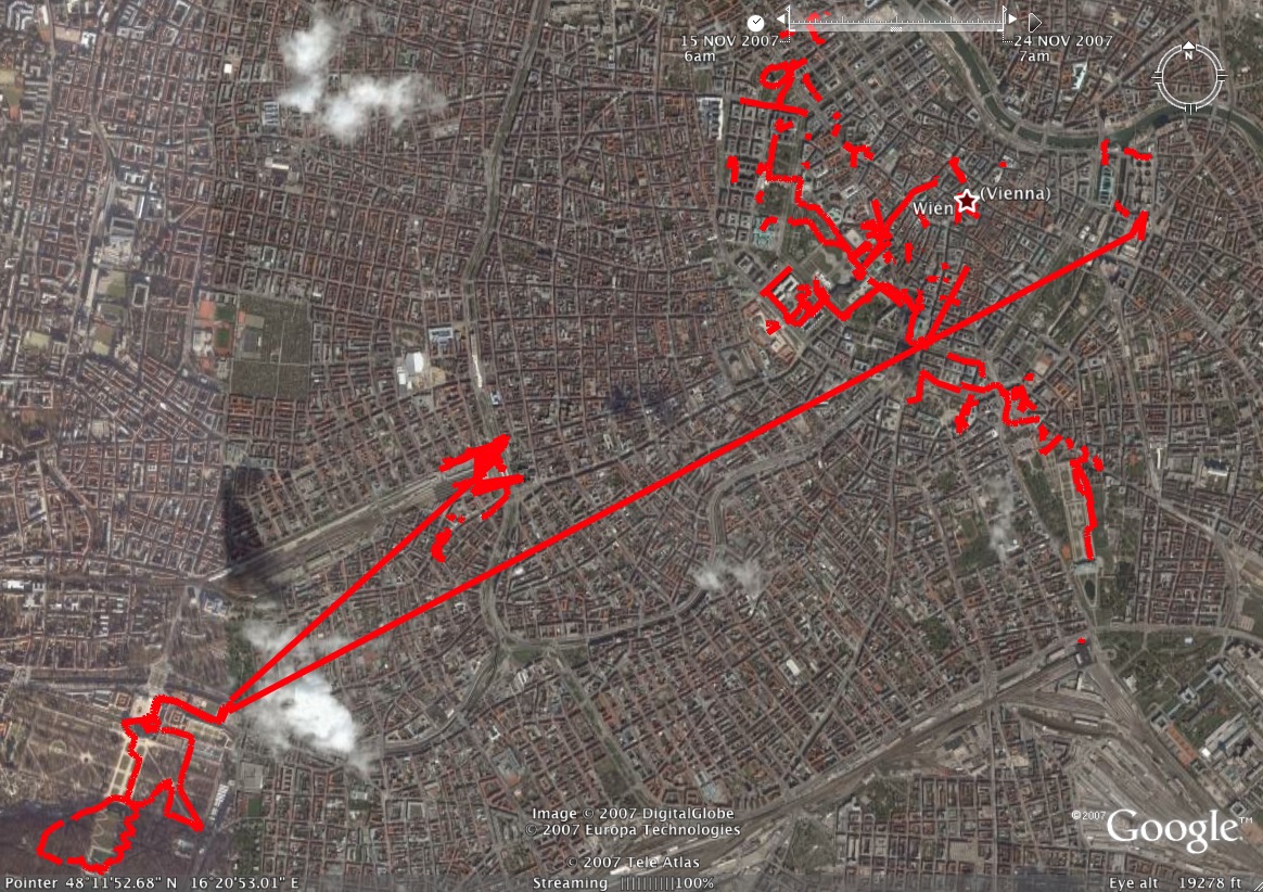
If you want to see our tracks that we did here’s a few different ways:
1) Download the GPX file and load it into your favorite program.
2) Download a Google Maps static image.
3) Download the Google Earth KMZ file. Download Google Earth here.
4) Or view it directly in your browser on Google Maps.
You can see all 531 photos from our trip to Vienna on the photodump.